Monday, September 18, 2017

9-18-17 Eastern Rockies and Good Friends (Eastern Slope of CO)


Rocky Mountain National Park, CO
We left South Dakota, and headed south and west toward Colorado.  Rather than drive one long day, we decided to take two days and add another national monument park to our trip.   


Covered Wagon at Scotts Bluff National Monument, NE
We spent one night at the Scotts Bluff National Monument in Gering Nebraska.  The bluff is along the Platt River and was a tall landmark used by settlers on the Oregon, Mormon and California Trails…all heading west.  We actually hiked along the Oregon Trail and could see the wagon wheel carved banks of the pass.  The air was filled with smoke again…from all the northwest forest fires and visibility was poor.  From the top of Scotts Bluff, we should have been able to see Chimney
Chimney Rock Ntl Historic Site, NE
Rock National Historic Site 20 miles to the east.  This was the landmark used by the westward traveling settlers just prior to Scotts Bluff.  It is hard to imagine walking all the way from St. Louis to Oregon, California, or Utah! The wagons only carried the food and water needed for the trip, along with any possessions needed to set up a farm or mine at the final destination.  It took a year or so for the trip, and many people did not make it.  These people must have had strong motivation to be so committed to make that trip in spite of the hardships!
 

Church on the Rock, Peak to Peak Hwy, CO
Our next destination was the fabulous Rocky Mountain National Park (RMNP) so we parked our motorhome in Estes Park, CO. We arrived during Labor Day weekend, so instead of fighting the crowds in the park, we decided to take the Peak to Peak Highway our first day.  It turned out to be crowded also.  We drove past the beautiful Longs and Meeker Peaks and south to Golden.  We wanted to tour the Coors Brewery (Bob did that in 1968 shortly after Coors opened), but the line was over 2 hours…so we passed and bought our Coors with lunch. 

Historic Storefronts, Central City CO
Instead we drove to two historic mining towns in the foothills:  Central City and Black Hawk.  Both turned out to be mostly casinos….with only historic storefronts kept for looks.  Very disappointing….the last time Bob was there, these were true historic mining towns.  The beautiful historic Elks Lodge cannot compete with free drinks at the casinos (a revenue generating function for many Elks Lodges), so it is only open for meetings. 


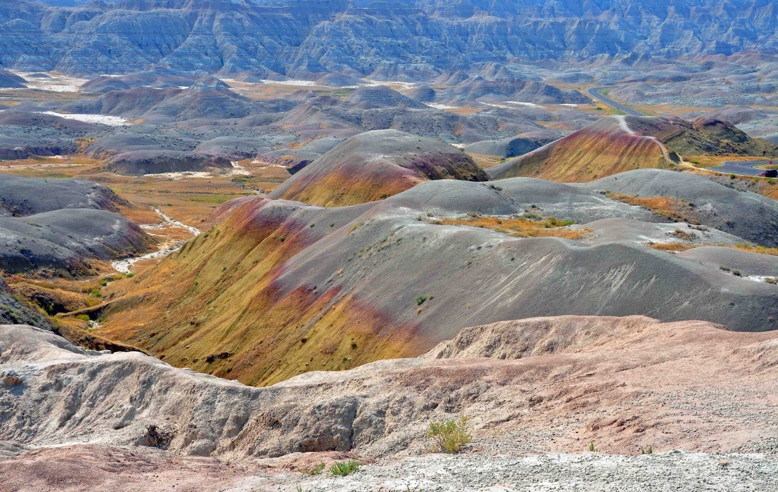
Headwaters Colorado River, Rocky Mtn NP, CO
We drove the entire RMNP road system, starting with a drive up the Old Fall River Road, the first auto road opened into the park in 1920.  The dirt road is so narrow that it is one-way traffic only up to the Alpine Visitor Center, the highest Visitor Center in the NPS.  The views should have been spectacular, but again the smoky haze prevented us from even seeing nearby mountains and appreciating the glacial valleys. The pine forests are not looking very healthy; the mountain pine beetle has already killed about half the pine trees (they were weakened by the long drought).  There are a lot of dead trees at higher elevations.   We did have the opportunity to see the headwaters of the Colorado River at the Continental Divide, and actually walk across it as a very small creek.   


Dream Lake on Early Morn Hike to Emerald Lake, RMNP
The last day there, we hiked the Bear Lake area.  It is very popular, and like Yosemite, you had to be there before 8am in order to find a place to park.  When we arrived, it was very cloudy and overcast.  We started the four mile hike up a steady 10% slope up.  We passed Nymph Lake, Dream Lake and finally reached Emerald Lake.  The sun finally came out and we could see the beautiful high peaks surrounding the lake and us.  We could understand why the hike is so popular…   


Male Elk Guarding "His" Heard, RMNP
The elk herds grazed in the valley, just outside Estes Park, and the males were in rut with the prime male with each small herd of females and juveniles.  We heard some elk bugle…but no contests for male supremacy.  Our favorite (and only) stop in Estes Park was the porch of the Stanley Hotel, another wonderful historic hotel.  When we first went there in the early 90s, it was by itself on a green hill with the lofty mountains above it.  This time, it was surrounded by suburbia….but still lovely.  We enjoyed a glass of wine on the porch while looking across at the mountains and the lake in town.   
Rocky Mountain Sunset from Porch Stanley Hotel, Estes Park
Sue Vargo and Linda, 39 years later.....
Between 1992 and 1994, Linda worked in Boulder and Bob worked in Denver.  We built a house in Broomfield on the open space between Denver and Boulder.  We had a beautiful view of the flatirons (foothills) and the white/snowcapped mountains (over 14K ft high) of the Rocky Mountains (with the smoky haze, we couldn’t even see the flatirons).   After leaving Estes Park, we had the opportunity to have lunch in Longmont with Sue Vargo, Linda’s co-student while getting her masters at the University of Maryland, 1977 and 1978 (Sue lives in Lyons).   

"Private" RV Park, Markel's Pasture, Broomfield
We also spent a wonderful couple of days with our long-term friends Dr. Bill and Jean Markel in Broomfield.  We used their horse pasture behind their house as our private RV “Park”. We really enjoyed our walk with Bill and Jean from their farm on the open space path behind our former house. It was satisfying to see that our design and work of 25 years ago were unchanged and still looking good. According to Jean, their friend’s son bought our house and still enjoys living there. 
The Back of Our Former Broomfield House, Great Views to the West
Dr Bill and Jean Markel, and Bob
Construction of Coors Field for the Colorado Rockies baseball team was started while we lived there (we watched the Rockies play in Mile High Stadium their first two years). So we went to Coors Field to see the Rockies get slammed by the Giants, but the beer and hot dogs were still good.  We then spent a wonderful day with Jean and Bill and enjoyed a great dinner on their patio (we picked the vegies one hour before dinner from their farm garden-fresh).  It is always so nice to see long-time friends (we don’t call them old friends anymoreJ); one of the wonderful parts of our 3 year adventure is seeing as many friends  as possible.    

AF Academy Chapel
We headed south from Broomfield to Colorado Springs for our last stop along the eastern slope. We camped on the US Air Force Academy and had a wonderful time visiting the academy. We could not believe how HUGE the Academy base is – it takes a long time just to drive around.  The chapel is beautiful and actually houses 4 different chapels.  The upper chapel is the Protestant Chapel and the largest with all the roof and side wall stained glass windows.  Below it are the Catholic, Buddhist and Jewish Chapels…  There are 23 different religious denominations that worship in those 4 chapels at various times.  The AF Academy STRONGLY encourages each cadet attend one.  They build leadership skills based on faith-based or non-faith based moral values and ethics.  One wonders how they can continue to do this in today’s anti-religious environment. The Academy’s soaring program is incredible and would really be fun to fly in – the primer to becoming a USAF pilot (but we have to say:  Fly NAVY!) 

Stained Glass Windows, Protestant Chapel, AF Academy
We were lucky to see the chapel as it is about to be closed for repair of the stained glass windows.  While beautiful, they have a tendency to leak.  We were told that the original contractor almost went broke trying to install them according to the original design.  Apparently, it is time to redo them – hopefully they will retain the original beauty.   

Linda and Our Cog Railway Car, Pikes Peak, CO
We have both driven to the top of Pikes Peak via the Pike Peaks Highway (Bob drove it long before it was paved in the 1990s due to dust and environmental reasons).  So we played tourists, along with busloads of seniors (I guess that includes us too) and took the Cog Railway to the top…great views of the canyon on the way up.  The visibility at the top was a little better than we had in the Rockies, but still not as good as we had seen in the past.  The fires throughout the west were still hurting the air quality.   

Garden of the Gods NM, Colorado Springs
Another crowned tourist stop (trap?) is the Garden of the Gods, a small park of beautiful tall spires of red rock. While the sandstone formations are scenic, our brief stop was somewhat disappointing – not the way we remembered it.  The loop road took less than 30 minutes. 
Linda at Seven Falls, CO
We then headed south to Seven Falls and the Broadmoor Hotel… another historic hotel.  The falls were interesting: a steep canyon with a single waterfall with 7 different plunge pools and sections.  To see it all, we hiked up 300 steps alongside the waterfall; it was so steep, it was more like a ladder.  The hike only whetted our appetite for a nice glass of wine at “The Hotel Bar” in the historic hotel (pretentiously billed as the “Best Bar West of the Hudson” – although we did not agree and thought it far from that claim!).   

Bob Next to Fossil Redwood Stump, Florissant Fossil Beds
Our last visit was to the Florissant Fossil Beds National Monument west of Colorado Springs.  The fossils were preserved by a shallow lake, formed by a volcanic lahar that blocked a river.  Most of the fossils are quite small: insects, plants, etc.  We spent a little time in the fossil lab, looking through microscopes to see various fossil forms (we loved the passion of the young paleontologist, but a little microscope goes a long way).  The only big features were huge fossilized stumps of redwood trees that had been buried alive in ash during the volcanic activity.  The surviving stumps indicate trees that were 250 feet tall.  Many of the fossilized stumps have been vandalized and taken by tourists prior to the area being protected as a National Monument. 

We continue to pray for the recovery of our friends and family and all those in Texas and Florida.  We are looking forward to getting back and doing what we can to help. 

For those unaware, our “Ramblin Adventures” actually started in 2005 with us cruising our sailboat to the Bahamas (1 season) and the eastern Caribbean (4 years). We have a strong attachment to the Caribbean islands and feel sad for their post-IRMA situation.  We know from our personal situation, most boat owners in the Caribbean are not wealthy.  It pains us to see the devastation to the charter fleet and private boats as well as properties.  We pray for all the residents, ex-pats, and cruisers as they try to rebuild the lives and recover their investments.  

We are now headed to the southwestern portion of Colorado and the four corners area, and then on to the north rim of the Grand Canyon and Arizona.  We thank God for his blessing and remain thankful to be able to continue our travels and exploration of this wonderful country.   

Feel free to pass the blog link on to anyone who might be interested.  
Best to all,
Linda and Bob  


Monday, September 11, 2017

9-11-17 Black Hills, Grasslands and Badlands (SD)

Badlands National Park, SD
We left North Dakota and made a long trip directly south, along two lane farm roads through prairie, farm and ranch land, to the western side of South Dakota.  We headed first to the Black Hills, and then to The Big Badlands of SD.  It was a beautiful drive and both destinations turned out to be fabulous places to visit, and we loved it all! 

Buffalo Herd, Custer State Park, SD
We set up camp at Custer’s Gulch RV Park in the middle of the Black Hills, in Custer SD, right outside the west entrance to Custer State Park.  This is one of the best state parks we have ever visited… certainly at the size and content level of a national park.  It has a lot to offer, and we tried to enjoy it all during the 10 days we visited the Black Hills. We still have more to see and do and hike…. Next time. 

State Game Lodge, Custer State Park
Custer State Park has two units, the south with rolling hills and prairie and lots of wildlife:  herds of bison, the ubiquitous prairie dog towns, turkeys, pronghorn sheep, and of course deer – both mule and white tail.   It turns out that the Black Hills is the intersection of eastern and western species for many forms of plants and animals…. You can find both in the same place.    The park also features several small lakes and 4 historic lodges, all very different.  The State Game Lodge, the oldest and most majestic, served as the summer Whitehouse for 2 presidents:  Eisenhower (1953) and Coolidge (1927).   
Bison Male Contest, Custer State Park
 

"Wild" Feral Burro Sniffing Bob's Hand for Food??
Mt. Rushmore through Iron Mountain Tunnel
The north part of the park is dramatically different with towering spires.  The Iron Man Highway is directly south of Mt Rushmore, and was laid out to take advantage of the proximity; two tunnels focus on the faces of the presidents as your drive through the tunnels!  The Needles Highway, which winds through the granite pinnacles and spires, is breath taking; with the added pleasure of seeing mountain goats traverse the vertical cliffs.  More tunnels, most too short and narrow for even a small RV.  The Needles Eye Tunnel even required some larger pickup trucks to pull in their mirrors! 
Mountain Goats, Custer State Park

Sylvan Lake Granite Pinnacles
Sylvan Lake was our favorite hike (to be honest, more of a walk); the small lake was formed by damming a small opening in a series of granite pinnacles that formed an almost solid cliff wall…it was quite spectacular to see.   

Mt Rushmore National Monument
Mt. Rushmore National Monument is just north of the state park.  Several people had told us they were disappointed in the Monument, so we were not sure what to expect.  We were pleasantly surprised…and really enjoyed our visit.  The challenge of designing and then executing the design were incredible (1927-1941). In fact, the head of Jefferson was originally supposed to be to the left of Washington, but half way through the chiseling, the rock was too unstable so Jefferson was moved to the other side of Washington.  We visited late in the day and had “dinner” and some uniquely delicious ice cream (Thomas Jefferson’s personal original recipe) at the Monument Café so we would be there to attend the evening lighting program. 

Mt Rushmore Lit at Night
The evening program started with a movie about the best of America, including an inspiring summary of the battle for Ft. McHenry in Baltimore Harbor, with all three verses of the Star Spangled Banner recited by the ranger.  The program ended with the entire crowd singing “God Bless America” with the lighting of the monument as the last word was sung.  All veterans in the audience were honored on stage. The evening lighting program was awe inspiring and definitely added much to our Mt Rushmore experience. We recommend adding the evening program to your visit. 

Washington Profile at Mt. Rushmore
With all the current “discussion” about confederate memorials, and the apparent effort to destroy and/or rewrite some of our history, a visit to Mt. Rushmore would help put all our history into perspective. All presidents are “only men” (or women), and subject to personal failings, and certainly each was a product of their times.  Yes, the early presidents were slave holders, but most wealthy men at that time were.   When you go through the exhibits and the movies, you understand clearly the reasons that each of the four presidents were chosen:   Washington was the founder of our country and risked death to start the union, Jefferson really expanded the country, Lincoln saved the union, and Theodore Roosevelt conserved the best of our nation.  We think the choices were excellent (of course no one after 1920 could be considered since they were not yet presidents).   It is unfortunate that too few of our fellow Americans no longer understand or respect history, and the lessons they tell.   

Devils Tower National Monumnet
Linda is a science fiction fan, so we had to go see Devils Tower, WY (of the movie Close Encounters of the Third Kind fame).  It is an igneous monolith (granite-like rock but without any quartz), with spectacular columns rising straight up from the plains.  You can see it from miles away.  We hiked the Tower Trail, which circles the tower.  It is a favorite for rock climbers, since the columns provide great cracks and crevices for free ascents.   

Total Solar Eclipse, 3 Flares,  Lusk, WY
During our visit to the Black Hills, we had the opportunity to drive only 100 miles southwest to be in the totality area for the Solar Eclipse.  Based on the forecast for cloud cover, we drove southwest rather than the closer directly south, to Lusk WY (normal population 1567, eclipse population – thousands more).  We left Custer at 4 am because we were unsure how many people would be trying to drive the very limited roads into the target areas.  We arrived before dawn, parked amongst other eclipse seekers, and beat the breakfast crowd for a nice breakfast (the restaurant had a line out the door and around the building when we left). After breakfast we took a nap in the car and woke up to a fun eclipse “party”.  

T
Diamond Ring Effect, Total Solar Eclipse, Lusk, WY
he eclipse started at 10:30 am and was at totality about 11:46 for about 2 minutes.  Linda got some good pictures with both cameras.  Several very serious eclipse hunters were near us, and they indicated that the corona looks different each time.  The hallmark for this eclipse was 3 flares…which we got pictures of.  We even got a picture of the hard to get, “Diamond Ring” effect as the eclipse starts and ends.  Once the total eclipse was over, we headed home.  We only had to wait an hour to get through the town of Lusk (only 10 blocks long) and across a two-lane bridge, but once through town, the traffic moved quickly.  We later heard that the people headed south to Colorado took 12 hours to get back home in the northern part of CO (Ft Collins for example); it seemed like half of Colorado and South Dakota was in Wyoming!  The Totality experience was definitely worth the pre-dawn departure and drive.
 

Deadwood, SD
We also visited Deadwood SD, the town of Western legends, in the northern part of the Black Hills.  The graves of Wild Bill Hitchcock and Calamity Jane are in the cemetery, along with stories of visits from other western legends (such as Bat Masterson).  The historic buildings are great, and the walking tour gave a great overview of life there during the “wild west days”.  There was an antique car show the day we were there, and the beginning of a 4 day music festival. We left before the festival really geared up…. too many people for us.  

Antique Car Show at Historic Train Station, Deadwood
Nearby, the town of Lead was the site of one of the largest and most profitable gold mines ever – the Homestead Mine, a huge open pit with many miles of deep tunnels. The mine is shutdown, but now hosts the Sanford Underground Research Facility.  The laboratory uses the previously deserted gold mine tunnels, at almost 5000 feet below the surface, to run physics experiments shielded from all types of cosmic “rays” and “noise”.  At this location, they proved the existence of neutrinos (black matter).  The technology was way over our heads, but after going through the visitor center, we understood “a little” about it.  The one compelling fact, the matter we see is only about 20% of the universe, with black matter (which we cannot see) is about 80% of the universe.  Physics has come a long way since either Bob or Linda took it in college over 40 years ago.   

Boxwork Formation, Wind Cave National Park, SD
Just outside the granite of the Black Hills, to the south and west, the sedimentary limestone is riddled with caverns.  We visited two of them.  Wind Cave in the Wind Cave National Park is the third largest cavern in the US, and one of the longest and most complex caves in the world.  It has over 174 miles explored, but based on airflow, it is estimated that only 10% of the cave has been explored. There is only one small opening to the extensive caverns, which can cause extreme air flow both in and out depending on the barometric difference between the air in the cave and outside (which is why it is called Wind Cave).  The highlight of Wind Cave is a calcite formation called Boxwork, a unique formation rarely found elsewhere.  We took a guided tour with normal cave lighting, and then experienced the cave as early explorers, climbing over rocks and up and down steep cave inclines, using only a candle lantern.   
Bob and Linda, Caving, Wind Cave National Monument

Calcite Formations, Jewel Cave NM
Our second cavern experience was Jewel Cave National Monument.  Similar to the complexity of Wind Cave, Jewel Cave is even longer with over 190 miles explored, and a lot more to be found.  The Scenic Tour highlighted the unusual chambers and passages almost completely covered with calcite crystals (thus the name Jewel Cave)….  Something we had not seen before so extensively.  Because of the size of the cave, and the single entrance, this cave also experiences winds due to barometric pressure differences in the cave and the air outside.  The caves are different enough to warrant a visit to both if you have the opportunity to visit them.  


Big Gap National Grasslands, SD
The grasslands and topography of the rolling hills derived from the limestone surrounding Wind and Jewel Caves is especially beautiful, particularly in sharp contrast to the adjacent rugged granite outcrops in Custer State Park. 

Mammoth Bones, The Mammoth Site, SD
South of Wind Cave, we visited “The Mammoth Site” (a National Natural Landmark Site) in Hot Springs SD.  This privately owned paleontological site (discovered during a building construction in 1974) contains the remains of fauna and flora preserved by entrapment in a karst sinkhole during the Pleistocene era. The sinkhole had steep sides, and after the animals went into the sinkhole for a drink of water, they were unable to get out, were trapped in the bottom, died and were buried quickly. Preservation of the bones (not fossilized) was excellent.   It is an active paleontological dig site, which boasts the largest concentration of mammoth remains in the world.  They have already recovered 61 mammoths and have only dug down 22 feet, with another 43 feet to go!   During the month of July they dig out the fossils (you can sign up as a volunteer); it takes the rest of the year, to process, sort and preserve the fossils recovered during that one month.  The Mammoth Site is comparable to The La Brea Tar Pits in LA, where similar ice age animals were entrapped in the tar pits.  
 
Incredible Palette, Badlands National Park, SD
 
Bighorn Sheep, Badlands National Park
We left the Black Hills of SD and headed two hours east through Rapid City to “The Big Badlands” of the Badlands National Park, SD  As you drive east on the plains, you suddenly drive down a “wall” into steep canyons and towering spires.  These Badlands contains dramatic landscapes, along with bison, bighorn sheep, pronghorn sheep, and prairie dogs on the extensive prairie surrounding the canyons and cliffs.  

Bob Climbing "The Ladder", Badlands
We enjoyed hiking through several canyons, and loved the hike to the Notch, a cut in the spires overlooking the prairie below, including climbing the steep ladder to get up a vertical cliff.  The vistas and canyon layers and colors are incredible…pictures cannot even begin to capture the majesty.  


Linda at Badlands NP Vista
Last year we enjoyed visiting the Badlands in the Plains of Alberta Canada east of Calgary with the intense thunder and lightning storms.  A few weeks ago we spent several days in the beautiful badlands of Theodore Roosevelt National Park in North Dakota.  Now we understand well why these South Dakota Badlands are truly “The Big Badlands”, as they are really awesome to experience.  

Only Bar in Interior SD
The town of Interior SD, 3 miles from our NP campground and population 67, bills itself as the oldest town in the badlands and where Jim Thorpe played in its fields, where Lawrence Welk played his early music, and the land that bred great Indian chiefs and mighty warriors.  Of course, Bob verified that the Wagon Wheel Bar and Grill has very cold long-neck bottle beer (no taps here).  The bartender, a Columbian, came to Interior to learn English.  He said “I had to learn English – no Spanish spoken here”.  

Minuteman II Missile in Silo
A surprising “hidden” aspect of the area was the proximity and extensiveness of the Minuteman Intercontinental Ballistic Missile (ICBM) sites.   The SD Air and Space Museum missile silo tour at Ellsworth Air Force Base outside Rapid City and the Minuteman II Historic Sites near the Badlands NP provided insight into the development and management of the Minuteman II ICBM program starting in the 1950 and 60s.  Over 1000 Minuteman II missile silos were spread out in the prairies and grasslands of the Great Plains; that number is now down to about 400 more powerful Minuteman III missiles.    

Minuteman II Missile Launch Control
The Minuteman Visitor Center included an excellent history of the Cold War, the proliferation of nuclear weapons, and the effectiveness of these weapons as a deterrent to nuclear war.  According to the information provided, North Korea already has 10 nuclear weapons, (and that was dated information), but maybe not small enough to fit into missile, YET.  We had the opportunity to tour a Minuteman II missile in its 80-foot deep silo, and the above and underground Missile Command and Launch Center (each center controlled 10 missiles).  

Antelope Herd, Buffalo Gap National Grasslands
Another unexpected treat was to drive through and experience the Buffalo Gap National Grasslands located in the vicinity of the Badlands NP.  We toured the National Grasslands Visitor Center in Wall SD; it is the only visitor center for all the 20 National Grasslands, mostly in the Great Plains. We now better understand what the homesteading “Sodbusters” had to deal with and why not many survived the Dust Bowl winds. The desert “farms” were purchased by the government after they failed, and revegetated into grasslands.   Originally administered by the US Soil Conservation Service from 1938 to 1953, and now managed by the US Forest Service.  The US Forest Service is trying to consolidate their patchwork of land holdings, to develop whole ecosystems. Currently, less than 2% of the original grasslands still remain in the US.  The grasslands are managed as multi-use properties, similar to BLM land; the grasslands support cattle grazing and oil and gas wells, but under strict conditions that support the preservation of the ecosystem.  These beautiful grasslands are often overlooked and not celebrated, but they are an important component in the Great Plains ecosystem and economy.   

Wall Drug, Wall, SD
Of course, we had to stroll through the infamous tourist mecca Wall Drug, also located in Wall SD; so named for its location on the western rim of the northern erosive wall of “The Big Badlands” topography.      

The SD weather and people have been super and we have really enjoyed out time here.  We could easily visit the Black Hills again; of course, avoiding the cold winter months.  From our wonderful South Dakota visit, we are headed south through Nebraska and west, to the eastern slope of Colorado.  Here we will spend some time visiting friends in the Boulder/Denver area, and Rocky Mountain National Park, and then down to Colorado Springs.   

We remain thankful and blessed to be able to continue our travels and exploration of this wonderful country.  It is hard to believe we are drawing close to finishing our 3 year adventure.   

Feel free to pass the blog link on to anyone who might be interested.  

Best to all,
Linda and Bob